PlumeGuard Drone | Aerial Radiation Mapping
Autonomous Situational Awareness for Hazardous Environments
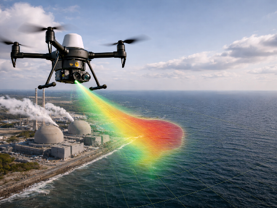
The Overview:
PlumeGuard is an AI-enabled aerial platform designed to detect and track radiation plumes. It provides rapid environmental assessment during industrial or nuclear incidents, significantly reducing personnel exposure to hazardous zones.
Key Technical Capabilities:
Dual-Sensor Integration: Combines gamma radiation detectors with thermal infrared imaging.
Real-time Mapping: Generates georeferenced plume maps using onboard AI processing.
Geospatial Tracking: Syncs radiation intensity with GPS and altitude data for precise dispersion patterns.
Remote Deployment: A modular drone payload designed for rapid emergency response.
The Impact:
Delivers critical data directly to ground stations, enabling plant operators and emergency responders to make informed, data-driven decisions with minimal risk.